Couple of puzzling issues and a new line of thinking
First a correction:
I initially stated that it looked like you had a depth of 584units, this should have been 58 units (584-526). This also make you elevation only 0.02% (two one-hundredths of a percent) of your plot area. Yes this is going to produce a very flat cloud.
Also your new data file, it seem you striped a lot of data from the file which is something I was going to talk about for testing. But I notice your elevations now have a 584unit range, but it jumps from 526 to 1110. ???
OK, new line of thinking:
*You stated that your data guys says the units are feet, correct ???
*How do we know the magnitude of the units between contour intervals ???
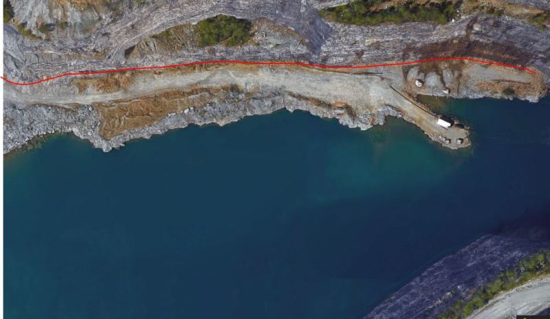
*Based on some views from the side of the quarry, a depth of 500 something feet looks a lot more accurate than 50 something feet ???, my thinking is 500ish based on quarries I have seen
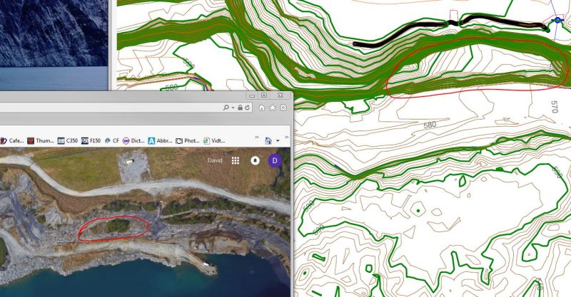
Based on you initial data set it appears that you have 25 + maybe 5 missing elevation sets of data. If the contour are only 2ft that makes a roughly 60ft deep quarry. This quarry LOOKS to be much deeper than that, so maybe they are 20ft contours which makes a more reasonable 600ft deep quarry. ???
And again going back to the Google map view the quarry appears to be in the range of 2000± feet across. Posted this already, but again is it possible that the plan data is in hundreds of a foot, such that your plot area of 243,000 by 245,000 is hundredths of a foot ==> this really being 2430ft, and 2450ft (fairly close to my 2000ft rough estimate of the width of this quarry).
???
![[bigsmile]](/data/assets/smilies/bigsmile.gif "[bigsmile] [bigsmile]")