Petras Surna
Structural
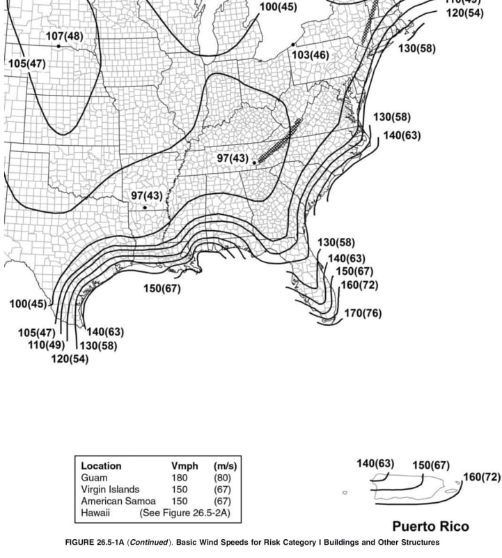
[tt]I am looking for an electronic definition of the maps in ASCE 7-10 for wind and snow.
The ideal solution would be a Google map that has the contours drawn as custom lines.
If that existed, I could get a definition of the contours as a list of latitude and longitude coordinates, put them in a database and find the
wind speed at any location by some programming.
As it stands, I am going to have to create these maps, which is a messy, time-consuming task.

[/tt]
The ideal solution would be a Google map that has the contours drawn as custom lines.
If that existed, I could get a definition of the contours as a list of latitude and longitude coordinates, put them in a database and find the
wind speed at any location by some programming.
As it stands, I am going to have to create these maps, which is a messy, time-consuming task.

[/tt]
