LittleInch (Petroleum),
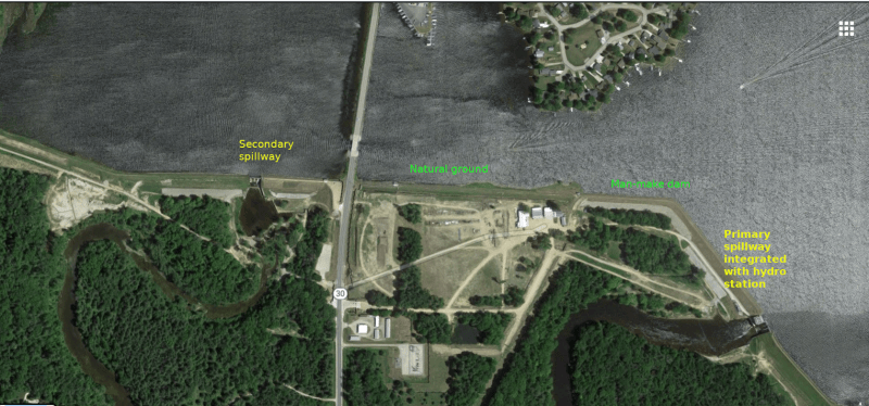
I would agree that there were two spillways, called Tabacco River and Tittabawassee River spillways according to the
Spicer Report. The emergency sections of them for overflow, if existed, were not clear.
It is interesting to note the
court papers served on Boyce the dam owner was about a drawdown of 8'.
The Spcier report describes the sill level of the spillways being 667.8ft and the normal lake level of 675.8ft. Thus the difference is exactly 8'. It is possible that Boyce wanted to leave the lake at a level so that all excess water would be discharged via the spillway, as that mean no attendent would be necessary for a defunct hydro plant.
The Spicer report also described the Federal estimates of Probable Maximum Flood (PMF) being between 74,360cfs (original), 61,936cfs(2011) and 67,800cfs(2013) for the Titabawassee/Tobacco rivers. Michgan State's own standard is apparently to mandate the dam to pass 1/2 PMF.
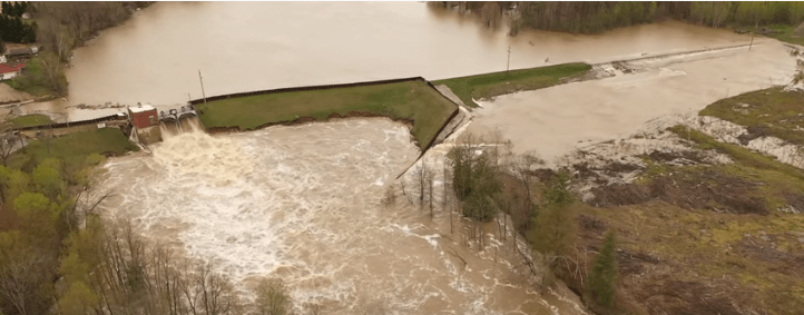
The combined net width of the two spillways was 129ft. Since the top of the dam is 682ft so the discharge capacity of the two spillways when the water level breached the top of dam is about
21,000 cfs which does not meet either the state or Federal requirement, according to the Spicer report.
Historical peak flow rates according to
this site ranged between 39,000 to 28,000cfs between 2017 to 1943. On the day of dam failure one report claimed a maximum flow of
60,000 cfs while another quoting a station further downstream at Sanford dam recorded
85,000 cfs
If the flow rate was anywhere near 60,000cfs then the dam was doomed even it has been modified to pass 1/2 PMF to satisfy the State's requirement.