We've already paid for the survey data. Google earth is good, but can be off by several meters, so we wanted to tie that down a little better since that will significantly impact earthwork quantities for both the reservoir and other civil site design items that are part of the study (channel to standpipe turbine, roads, accompanying industrial park, etc.).
This is a feasibility study, so our goal is to get to 50 percent construction docs. That will satisfy the grant and will position us to raise funding to actually build the project. We will bring on more highly specialized consultants for tasks that we need help with at that point. My partner recently came back from a 3 week visit to Malawi, so yes, onsite work would certainly be part of final design and construction if we can push it that far.
Depth of the reservoir verses breadth should not be an issue. The topo is very steep so it will be a relatively deep reservoir.
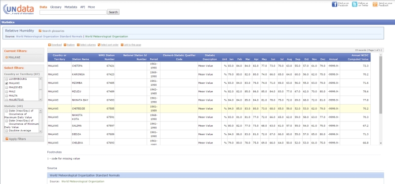
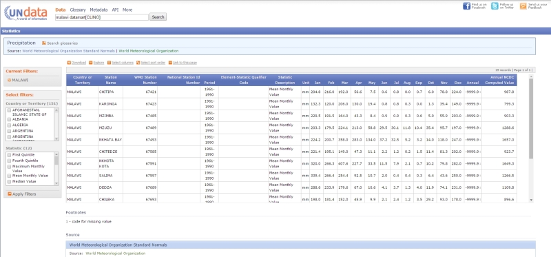
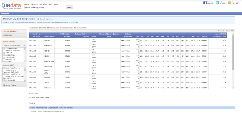
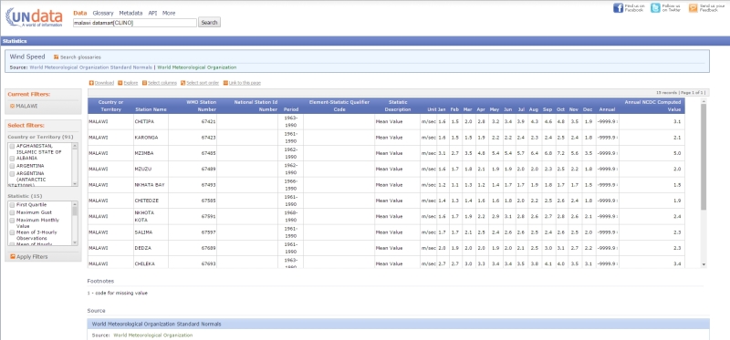
Evaporation may very will be virtually negligible considering the size of the project and the other variable conditions such as river flow rate and rainfall. This is definitely a judgement better made by an engineer who works regularly with water resources. My concern is that there is a 3-4 month rainy season and then virtually no rain for the remainder of the year, although the river will flow throughout the year. Back of the envelope, how big does a reservoir need to be for evaporation to be of significant concern?
It seems that the biggest drawback to over-estimating evaporation would be a larger dam than required. That would increase construction costs. But assuming those could be covered, what other problems could arise from over-estimating evaporation? Having a larger reservoir would be preferable (provided the costs can be justified) as that extra capacity could be used to generate more power or even provide some limited irrigation to the local farmers.