[Clouds] Assuming it's not steam.
We get a lot of clouds forming right at the top of the lower ridges. We have a rather clean, laminar air flow upstream of the islands. It hits the islands and starts building waves as the wind blows up the slope and over the ridge. Its not the typical vertical lift of warm air that builds mainland cumulus clouds. Here, its the rise up the slope, a drop of temperature as Alistair mentioned, plus the venturi effect. We usually get breezes off the ocean that are at or nearly at 100% humidity, totally saturated, so all it takes to condense the water vapor is just any tiny drop in either temperature, or pressure. Sometimes we see clouds form just as they go over the ridge, without any great change of temperature from one side to the other. No clouds upstream, clouds immediately downstream. I figure there is a low pressure zone on the lee side of the ridge that condenses any water vapor by the pressure reduction and poof, a cloud is formed. I've seen that landing in Dubai and Jeddah, and Houston. Alistair probably has seen it too, although not from the pilot's seat. When you lower the flaps in extremely humid weather, you can see water vapor condensing off the trailing edge. Surely the temperature is roughly the same in front and behind the flaps, so its the pressure change. Those clouds on the ridge there in that picture can also be the initial primary formation of a wave of a series of clouds that often form at regular intervals downstream of a high ridge, especially without other topographic features to introduce turbulence. The clouds will keep their original wave length and form at the same distance interval between them downstream of a ridge and will generall get higher as distance from the ridge increases. Below ridge level, there is often a rotator effect that I mentioned somewhere above was backdrafting the steam from the cascade into the ocean back over the town. And I saw one ISS space shot somewhere of the huge vortex that was being generated by this volcano. So, it is possible that in this case the volcano is the motive force for an uplift, although the prevailing winds will easily drive the air over the top of the ridge by itself. I'm on the north side of Tenerife, so I see the prevailing winds climb up the cliff every day. There's most always clouds forming up at the ridge elevation, only 700-800m high. They rise a bit as the daily temperature goes up, but then come back down during the evening and night. I learned a lot about clouds since I got here! Some nights we get so much condensation, you'd think it really rained. Most of the plants survive here by condensed water from their leaves, or in the case of the Canary Pines, needles. Most of our drinking water is also condensed and collected in volcanic caverns up on the ridge.
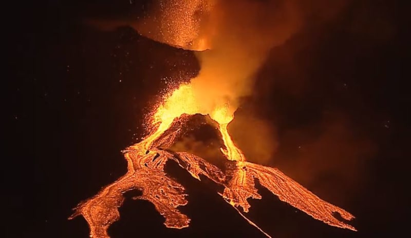
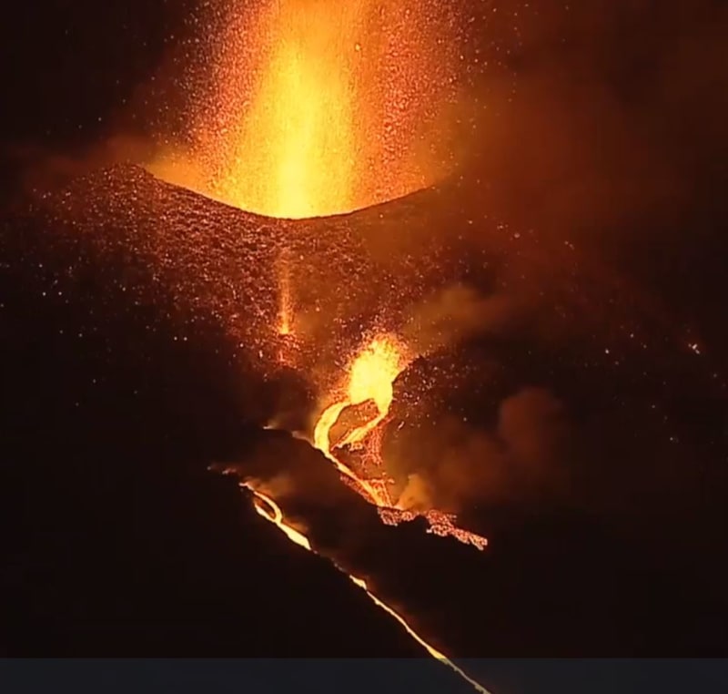
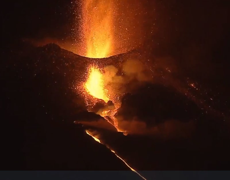
All that said, in this video it looks like they are gases escaping from the uphill creater remains of the first cone that melted and went sliding down the mountain.
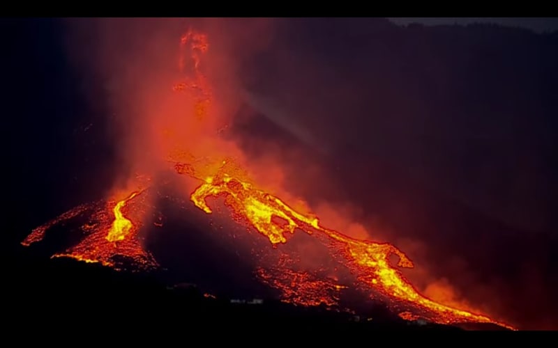
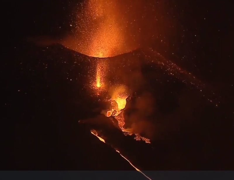
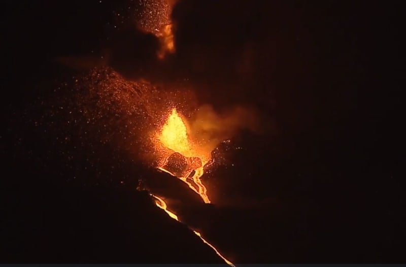
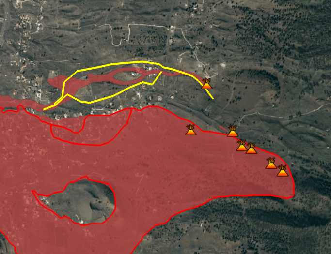
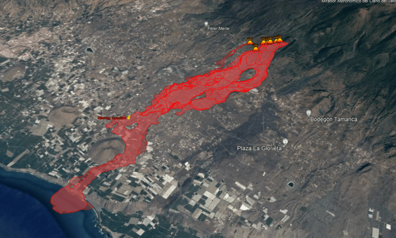
This thing has vents opening, closing and moving all the time. I was curious about this as well and this morning I actually did a plot of all the vents since day 2. It is in the Google Earth file I am attaching. The latest lava flow is from a vent that opened up 400m from the original group, to the NNW.
That new lava stream is flowing more or less parallel to the original stream. I was confused by that myself, as there has not been much flow of technical information in the news channels lately. Everyone wants to know what kind of economic assistance will be made available. Anyway, I found some drone flight videos made yesterday and I was able to determine their flight path as they took footage of the new flows. I have plotted the path of the new flows in the same google earth file in yellow. There are 4 placemarks that should give you the same view of the drone photos at the times indicated. The Youtube URLs for two videos are referenced to the placemarks, double click on the placemarks and you will see the URL. Click on that and it should open to the drone video. Scroll to the time indicated on the placemark.
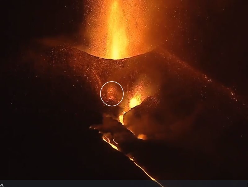
I think D is something caught fire. Anyway, you can try to compare that location to the vent locations. Its kind of a flat angle, so it won't be easy.
![[ponder]](/data/assets/smilies/ponder.gif "[ponder] [ponder]")


") that is good to know.
that is good to know. ![[lol]](/data/assets/smilies/lol.gif "[lol] [lol]")