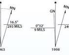
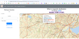
Hello, I am plotting deeds in Somerset, NJ and without fail the bearings on these deeds are always off by about 5 degrees from the NAD83 foot NJ State plane. Does anyone know what is going on, and what the exact error is. My guess is that the surveyors who plotted these deeds used magnetic north instead of geodetic north and as such were off by a certain amount. What is happening, and what is the exact angle difference between these plotted deeds and the NJ State plane? Thanks.
Eng-Tips is the largest forum for Engineering Professionals on the Internet.
Members share and learn making Eng-Tips Forums the best source of engineering information on the Internet!
-
Congratulations JStephen on being selected by the Eng-Tips community for having the most helpful posts in the forums last week. Way to Go!
NAD83 Datum questions
- Thread starter cschear
- Start date


