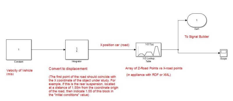
"I need ground elevation values based on time"
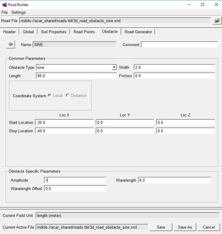
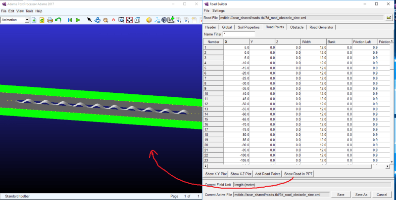
In this case, the coordinates from the road file will not give you anything. I mean those that are open with help with the Road Builder menu in the Road Points tab (Z coordinate). These are just specific static profile points. In motion, еheir height will vary differently depending on the speed of the car. I suppose for this you used Acar - to match height and time. Well, if current measures do not help you, try creating Run-Time Clearance in template. It shows the shortest distance between objects. In the settings, specify the Contact Solid and Road Graphics types.
Now, it seems, we are moving in the right direction ...