Technical definitions are more complex.
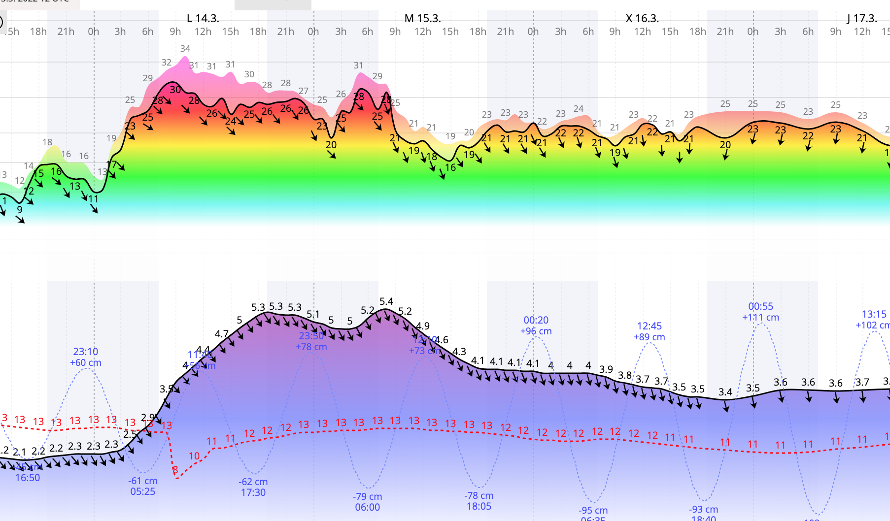
High tide is the maximum height reached by each rising tide. The high-high and low-high tides are the higher and lower of the two high tides, respectively, of each tidal day. (See NOAA Web site: See "High water")
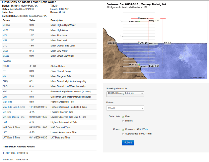
Mean high or low tide is the average of all high or low tides, respectively, over a specific period.
Mean sea level is a local tidal datum. It is the arithmetic mean of hourly heights observed over the National Tidal Datum Epoch. Shorter series are specified in the name; for example, monthly mean sea level and yearly mean sea level. In order that they may be recovered when needed, such datums are referenced to fixed points known as benchmarks. (See also "Datum")
Low tide is the minimum height reached by each falling tide. The high-low and low-low tides are the higher and lower of the two low tides, respectively, of each tidal day. (See NOAA Website: See "Low water")
National Geodetic Vertical Datum of 1929 (NGVD 29) is a fixed reference adopted as a standard geodetic datum for elevations determined by leveling. It formerly was called "Sea Level Datum of 1929" or "mean sea level." Although the datum was derived from the mean sea level at 26 tide stations, it does not necessarily represent local mean sea level at any particular place. See NOAA Web site:
(See "North American Vertical Datum of 1988")
Why is the GMSL different than local tide gauge measurements?
Storm tides, flood tides, storm surge are usually those higher than high high tide levels. They are defined locally whereas mean sea levels, which vary for every specific location, are defined from the Earth's center. Mean sea level does not describe a uniform level water surface. If it did, and all mountain elevations were referenced to the same level, Mt Everest would not be the highest mountain in the world.
A black swan to a turkey is a white swan to the butcher ... and to Boeing.