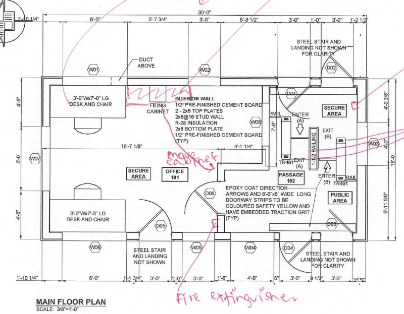
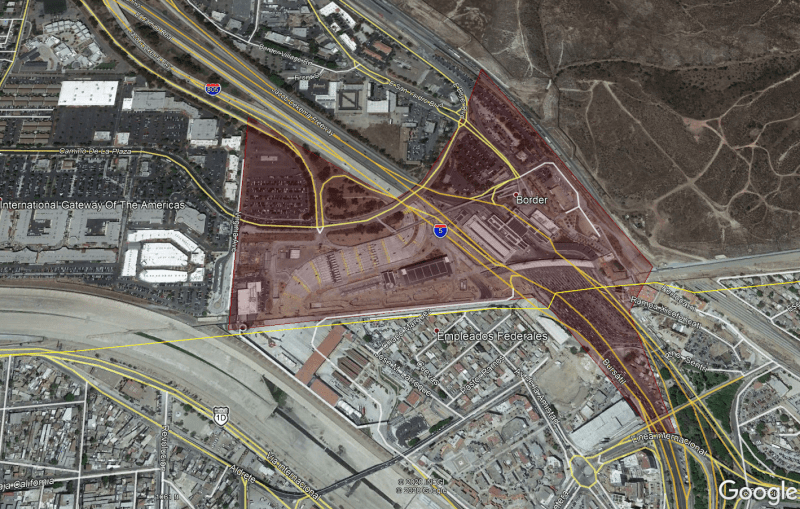
You can use Google Earth to look at hundreds, maybe thousands, of border crossings all around the world. I doubt any two are alike. Certainly the ones I have seen in Google Earth and the half dozen or so USA-Canada border crossings I have driven through are all different. That being said, Google Earth is a good starting point for seeing how other engineers have laid out border crossing posts. You need to consider "functional layout" (a term I learned from working with architects that describes how rooms with similar and different functions and paths of travel should be located with respect to each other.), site constraints, security requirements, etc., much like any other civil layout.
============
"Is it the only lesson of history that mankind is unteachable?"
--Winston S. Churchill